Who we are
SPEX develops hyperspectral payloads, data processing pipelines, and analysis solutions for Earth observation applications.
Founded by astronomers, we apply space-proven spectroscopy to Earth observation.
We turn spectral data into insight.
From composition to physical conditions, we extract meaningful information from light.
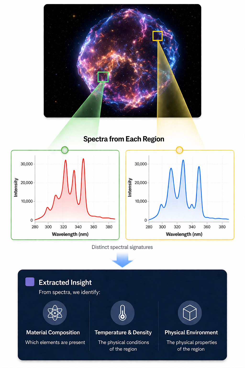
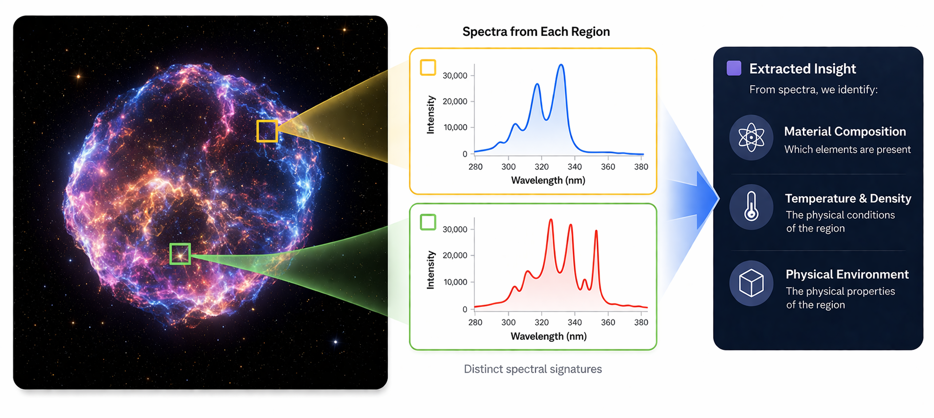
Each region produces a unique spectral signature.
By analyzing these patterns, we identify composition, temperature, and physical conditions, even from a distance.
Technology proven in space,
now applied to Earth.
Technology proven in space,
now applied to Earth.
SPEX is developing hyperspectral imaging payloads for satellites in Korea.
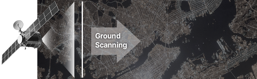
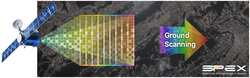
Today’s spaceborne HSI often relies on push-broom scanning, a proven architecture for wide-area coverage.
Building on this foundation, we explore advanced astronomical techniques to improve spatial-spectral efficiency.
In parallel, we develop end-to-end calibration and validation workflows that transform raw measurements into reliable hyperspectral products.
Next-generation hyperspectral payloads for satellites
Next-generation satellite hyperspectral payloads
SPEX is developing hyperspectral imaging payload technologies for satellites in Korea.
Today’s spaceborne HSI often relies on push-broom scanning, a proven architecture for wide-area coverage.
Building on this foundation, we explore advanced astronomical techniques to improve spatial-spectral information efficiency.
In parallel, we develop end-to-end calibration and validation workflows that transform raw measurements into reliable hyperspectral products.
Designed to deliver richer spectral information.
Better data starts with deeper understanding.
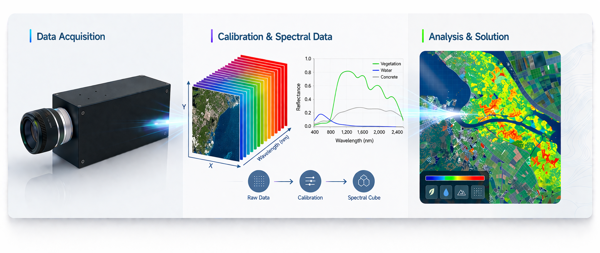
From data acquisition to insight
SPEX develops hyperspectral data analysis workflows and solutions for Earth observation.
By developing and validating hyperspectral instruments in parallel, we gain a deeper understanding of how spectral data is acquired, calibrated, and transformed into reliable products.
This end-to-end perspective helps us deliver more trustworthy analysis, clearer interpretation, and more practical solutions.
Better data starts with deeper understanding.
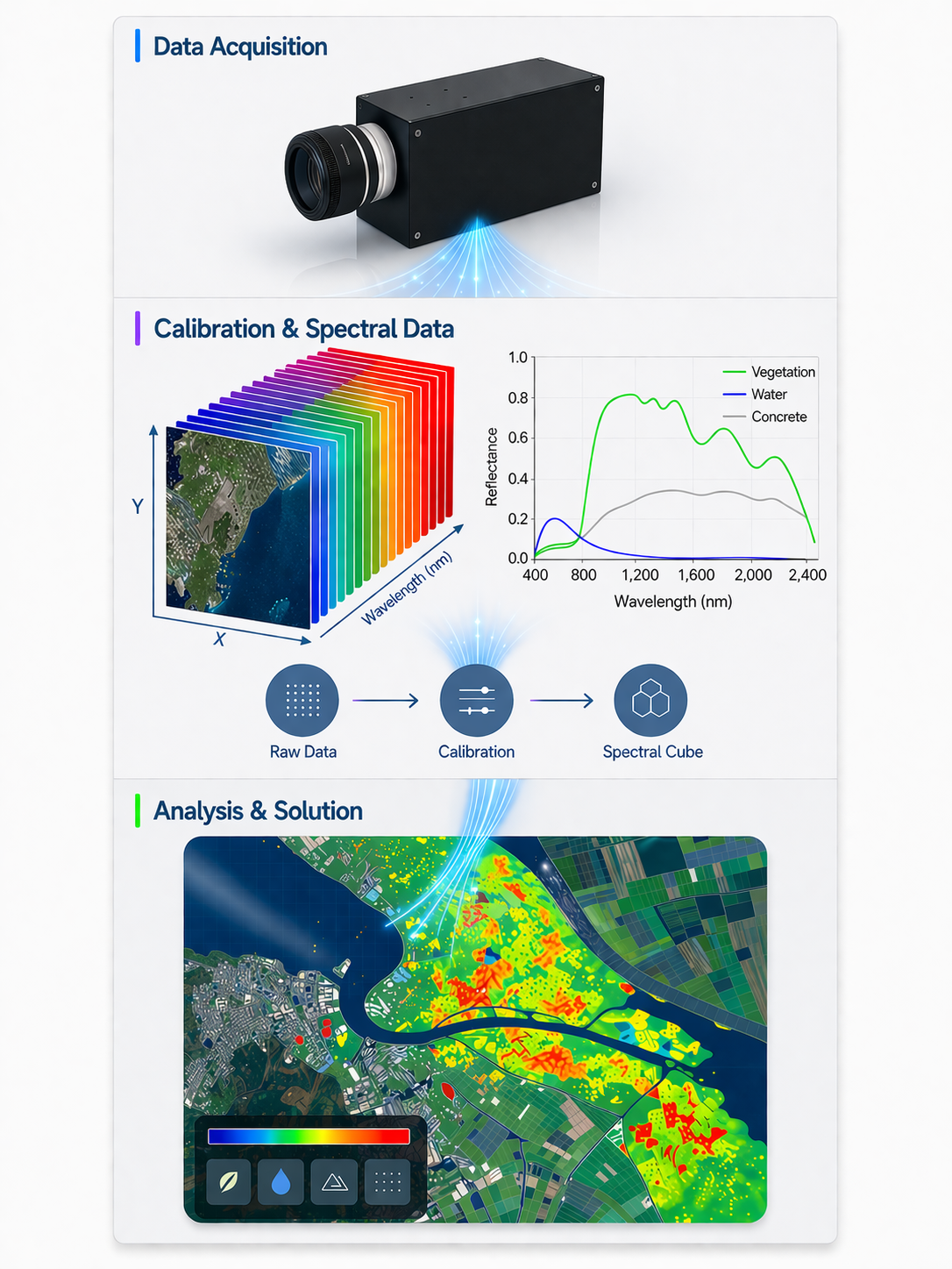
→ Drone-based hyperspectral payload over Jeju farmland captured rich spectral data in real-world outdoor conditions.
→ SPEX translated the measurements into intuitive vegetation maps that revealed field variation beyond conventional RGB imagery.
→ This project demonstrates our end-to-end capability in field acquisition, spectral processing, and application-ready mapping.
→ The data revealed subtle condition differences and turned them into clear, interpretable contrast maps.
→ This project shows how SPEX turns spectral data into clearer vegetation insights beyond conventional RGB imaging.
▮July 2025 | Presented at the 6th Korea Geoscience Union Meeting & IASS Workshop 2025
▮December 2025 | 2025 Aerospace Open Ground Program
Featured Projects
Drone-based hyperspectral field mapping in Jeju
▮December 2025 | 2025 Aerospace Open Ground Program
→ Drone-based hyperspectral payload over Jeju farmland captured rich spectral data in real-world outdoor conditions.
→ SPEX translated the measurements into intuitive vegetation maps that revealed field variation beyond conventional RGB imagery.
→ This project demonstrates our end-to-end capability in field acquisition, spectral processing, and application-ready mapping.
Hyperspectral analysis of vegetation samples
▮July 2025 | Presented at the 6th Korea Geoscience Union Meeting & IASS Workshop 2025
Sample classification
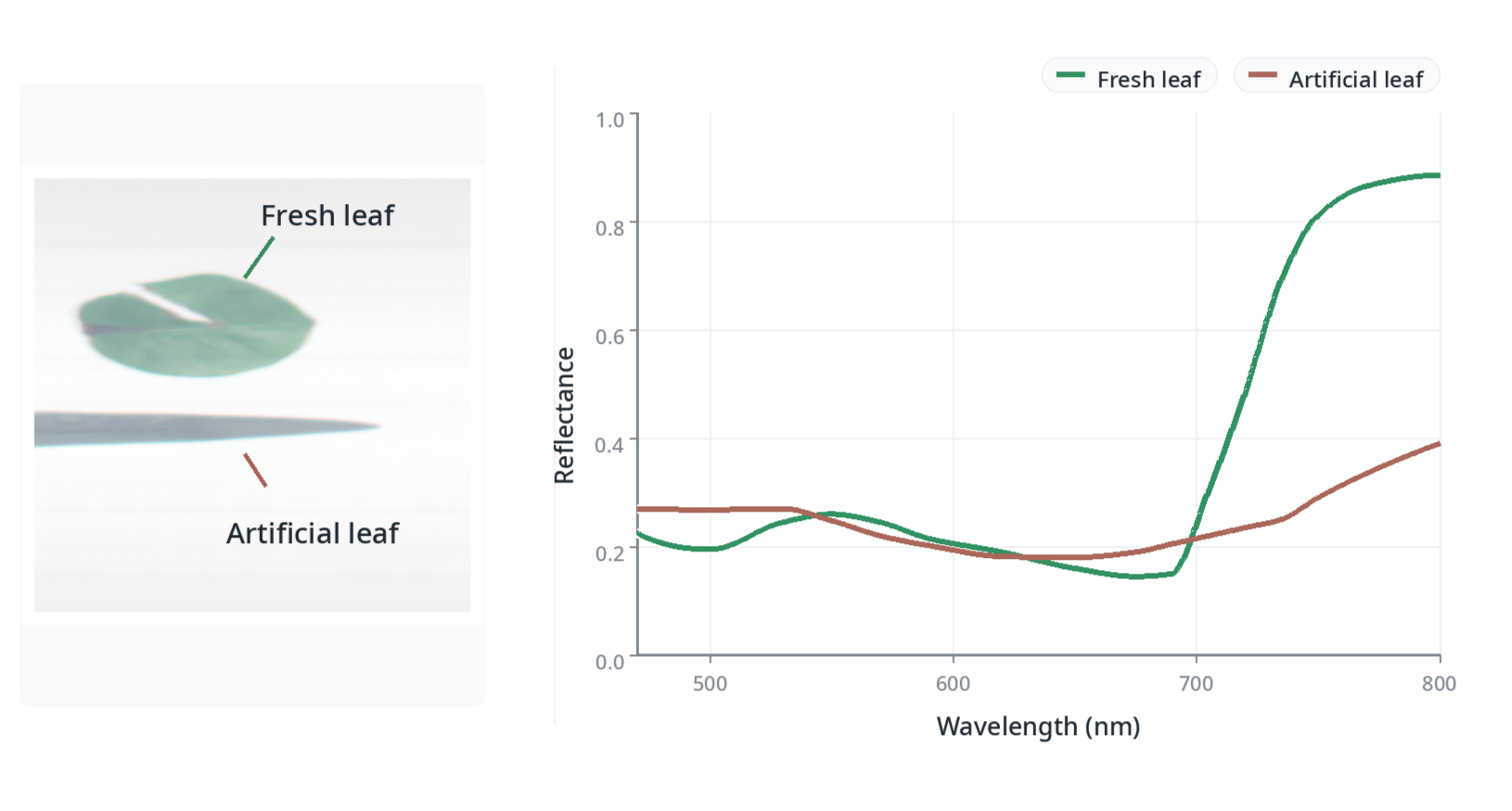
→ Hyperspectral reflectance analysis clearly distinguished artificial and fresh leaves.
Leaf condition mapping
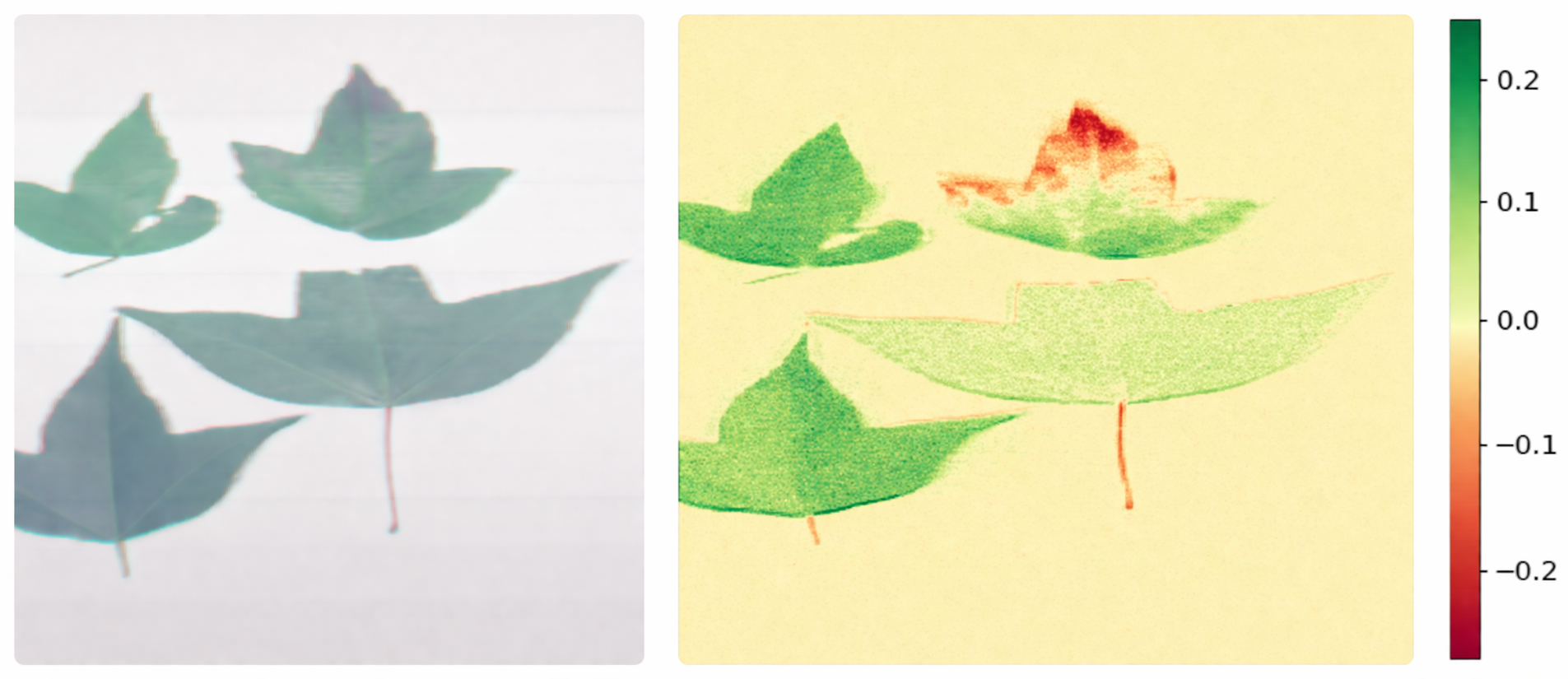
→ Across 472-750 nm, the data revealed subtle condition differences and turned them into clear, interpretable contrast maps.
→ This study shows how SPEX converts spectral data into vegetation insights beyond conventional RGB imaging.